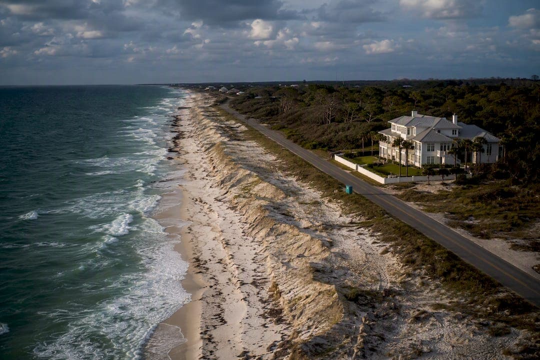
Santa Rosa Beach and neighboring Santa Rosa Island carry a documented hurricane record shaped by repeated direct and near-direct hits, including Opal (1995), Ivan (2004), and Dennis (2005). Post-storm surveys from the USGS and Florida DEP show recurring dune erosion, storm tides exceeding 10 feet in places, and hundreds of damaged structures across the region. For property owners, the takeaway is straightforward: plan for coastal change and prioritize surge and flood protection over wind alone.
TL;DR:
- Coastal erosion from storms like Dennis, Ivan, and Opal has significantly reshaped Santa Rosa Beach’s shoreline since 1995, with the worst damage occurring during that decade.
- Storm tides of 10 to 15 feet repeatedly overtopped dunes, especially during Dennis, leading to overwash that buried roads and damaged structures, with dune conditions greatly influencing damage severity.
- Property damage results more from flooding and water intrusion than from wind, making flood protection and dune preservation essential for resilience.
- Focused weekly inspections and early preparedness, including moisture monitoring and drone surveys, help property owners minimize repair costs and accelerate storm response efforts.
- Supporting dune health and understanding hurricane deductibles before the season can significantly reduce storm impact and financial surprises.
Table of Contents
- Santa Rosa Beach Hurricane History: A Timeline of Major Storms
- How Storms Reshape the Coast: Dunes, Roads, and Utilities
- Where the Storm Data Comes From
- What This Means for Your Property This Hurricane Season
- An Estate Manager's Read on This History
- Sources
Santa Rosa Beach Hurricane History: A Timeline of Major Storms
The stretch of coastline near Santa Rosa Beach sits inside one of the most storm-exposed corridors in the continental United States. More than 50 hurricanes have tracked through the broader Emerald Coast region since 1930, and researchers point to a distinct cluster between 1995 and 2005 that reshaped the shoreline in ways still visible today, according to USGS coastal-change research.
Here's how the major storms line up:
- Hurricane Opal (1995): Made landfall near Pensacola Beach as a strong Category 3, driving significant surge into Santa Rosa Sound and setting off decades of renewed attention to dune protection along the island.
- Hurricane Ivan (2004): A Category 3 landfall near Gulf Shores that stripped large sections of foredune along Santa Rosa Island, leaving the coast thinner and more exposed heading into the following year's storms.
- Hurricane Dennis (2005): Struck Santa Rosa Island directly as a Category 3 on July 10, 2005, with storm tides reaching roughly 15 feet in spots like Navarre Beach, according to USGS Fact Sheet 2009-3027. It remains the single most studied storm for this stretch of coast.
- Hurricane Katrina (2005): Passed farther west but still contributed to the regional erosion and structural damage totals that Florida DEP's comparative analysis tracked across eight northwest Florida counties that season.
- Hurricane Michael (2018): A catastrophic Category 5 landfall well east of Santa Rosa Beach, but its wind field and surge still touched Walton and Santa Rosa County shorelines.
- Hurricane Sally (2020): A slow-moving storm that dumped extreme rainfall on Santa Rosa County, where flooding, not wind, drove most of the property loss.
The 1995 to 2005 decade did more damage to the dune system than any other single period on record, which matters more than any one storm's category.
How Storms Reshape the Coast: Dunes, Roads, and Utilities
Wind gets the headlines, but water and sand movement do the lasting damage. When Dennis crossed Santa Rosa Island in 2005, post-storm aerial surveys documented widespread overwash, where storm tide pushed straight over the dune line and buried roads, parking areas, and bathhouses in sand, according to the same USGS fact sheet.
Three patterns show up consistently across the region's storm record:
- Storm tides measured in the range of 10 to 15 feet during Dennis overtopped protective dunes in multiple locations along the island.
- Repeated storms compound each other. Ivan stripped dune vegetation and elevation in 2004, and Dennis hit that same weakened dune line less than a year later with far more overwash than a comparable storm would have caused on a healthy dune.
- Erosion surveys tied to the 2005 season document beach and dune sand losses across eight northwest Florida coastal counties, per Florida DEP's analysis.
A dune's condition going into hurricane season is the single biggest predictor of how much damage the next storm does. A foredune that survived the prior season intact absorbs surge energy that a stripped dune simply passes through. That is why researchers treat storm clusters like 1995 to 2005 as a distinct risk category rather than a string of unrelated events, according to USGS.
Where the Storm Data Comes From
The historical picture of Santa Rosa Beach hurricane impacts rests on a small number of primary sources, and it's worth knowing what each one actually measures.
| Source | What it provides | Best used for |
|---|---|---|
| USGS fact sheets and aerial surveys | Before-and-after coastal imagery, measured shoreline retreat, dune elevation change | Confirming physical coastal change after a specific storm |
| Florida DEP comparative analyses | County-level erosion and structure-damage tallies across storm seasons | Comparing damage scope across multiple counties and storms |
| NOAA / AOML storm pages | Best-track data, wind speeds, synoptic storm history | Verifying landfall location, category, and timing |
| NOAA geodesy storm archive | Tide gauge and water-level records | Checking measured storm surge at specific stations |
USGS relied on aerial photography flown before and after Dennis, comparing July 2001 imagery (pre-Ivan) against September 2004 and July 2005 flights to isolate how much beach and dune volume each storm removed. Florida DEP's damage tallies are useful for scope but represent estimates compiled quickly after a storm, so treat exact structure counts as directional rather than final. NOAA's Dennis storm pages remain the reference point for confirming wind speed and track claims you'll see repeated across other sources.
What This Means for Your Property This Hurricane Season
Water intrusion, not wind, causes most of the expensive damage in this region's storm history. Sally's 2020 flooding in Santa Rosa County proved that even a storm without a high wind category can leave homeowners facing months of remediation. Here's what that means for how you prepare:
- Document your property before the season starts. A current set of digital condition reports gives you and your insurer a clear before-and-after baseline if a claim happens.
- Secure or elevate outdoor assets early. Furniture, grills, and dock or boat equipment left exposed become both storm debris and separate insurance headaches.
- Install moisture monitoring where water intrusion is likely. Sensors that flag a leak within hours, not days, are what keep a wet wall from becoming a mold remediation project.
- Understand your hurricane deductible before storm season, not after. Percentage-based deductibles can run into five figures on luxury properties, and surprises are expensive.
- Support dune health on your property or adjacent easements. Native vegetation and coordinated erosion control landscaping reduce how much sand and elevation you lose in the next storm cycle.
Pro Tip: Line up a local estate manager or home watch service before hurricane season opens in June, not after a storm is already in the forecast. The properties that come through cleanest are the ones with someone local already inspecting weekly, so pre-storm prep and post-storm mitigation start the same day the storm does, not three days later when contractors are already booked solid.
A wind mitigation inspection is also worth scheduling well before season, since it can lower premiums while flagging roof and opening vulnerabilities you'd rather fix on your own timeline.

An Estate Manager's Read on This History
The pattern in Santa Rosa Beach's storm record is not really about any single hurricane. It's about what happens in the days right after one. Homes that get a fast, competent response, tarps up before the next rain band, moisture pulled out of walls within 24 to 48 hours, debris cleared before it traps standing water, come through a season with a repair bill instead of a rebuild.
Weekly inspections matter for the same reason dune health matters: condition compounds. A property already being watched closely has fewer surprises baked in when a storm approaches, and a faster, better-informed response when one passes. That is the gap between reading about Dennis or Sally in a report and actually being ready for the next one.
— Zackary
30apropertycollective builds storm readiness into ongoing estate care rather than treating it as a once-a-year scramble. Weekly inspections catch the small issues, a stressed dune line, a failing seal, a clogged drain, before they become storm-season liabilities, and the same team that watches your property year-round handles pre-storm prep and post-storm mitigation without a handoff delay. If you want that kind of anticipatory care in place before the next system enters the Gulf, explore concierge and estate management services built for Emerald Coast homeowners.
Sources
- USGS Fact Sheet 2009-3027: Coastal change during Hurricane Dennis (2005)
- Hurricane Dennis and Katrina comparative analysis — Florida DEP
- Hurricane Dennis (2005) — NOAA/AOML
- Storm-induced coastal change — USGS